
Friend or Foe – A Brief Snapshot of the Morecambe Structure
Nestled within the prairies of Two Hills County is a structure that was built to meet the community's needs in the 1970's, but its history is more complex than meets the eye. On a sunny mid-October day, students in the Bachelor of Applied Science (BASEM) program at Lakeland College were given the opportunity to team up with the Government of Alberta and the Vermilion River Watershed Alliance (VRWA) to learn more about the structures within our watershed. During this academic endeavor, we visited the Morecambe structure, where we learned about the dam's history, its influence on the riparian area, how water interacts with the dam in relation to local topography and the impact the dam has on the surrounding communities.
As environmental stewards and members of the community, BASEM students are familiar with the importance of local water sources and the ecological services they provide, including water filtration, aquifer recharge, habitat, and many other benefits that serve the local community. Visiting the Morecambe structure allowed us a closer look at how management practices influence the interaction between regulated rivers and the surrounding landscape.
“The Two Hills floodplain is like pouring water onto a coffee table” (Soehn 2024). The topography of the area is low and flat, descending at a rate of approximately 1.6 cm per kilometer and draining through six shallow lakes upstream. In fact, the water can take more than 7 days to travel 30 km, a primary cause of flooding in the area. However, the flooding provides essential nutrients to the associated floodplain and riparian area, making the river basin a hotspot for agriculture, rich in nutrients that promote crop growth.
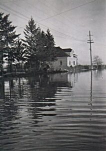

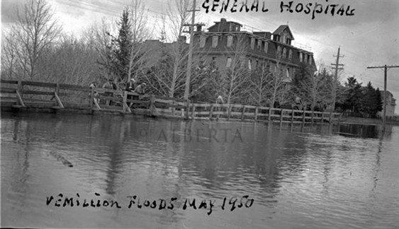


A 1-in-200 flood event occurring in 1974 resulted in severe flooding of crops, roads, houses, and businesses within the Two Hills area, ultimately leading locals to lobby the government for a solution. A study and report on the Vermilion River Basin were conducted shortly thereafter, and three main problems were identified: 1) flooding caused damage to native hay crops, 2) runoff from snowmelt presented a more significant issue than high flows, and 3) the largest Vermilion River floodplain, located in Two Hills County, drains water extremely slowly after a flood event. These findings prompted the regular maintenance of channels between the lakes to improve flow, as well as enhancing the discharge capacity adjacent to the natural outlet of the last lake by constructing a man-made structure to help with drainage.
The Morecambe structure was constructed in 1974 and began operations in 1976 to reduce flooding. While it was recognized that the installation of the dam would help mitigate the impacts of flooding rather than eliminate unwanted flooding, what was not expected was an increase in flooding downstream. Consequently, an operational plan was implemented in 1987 to balance upstream and downstream flood dynamics. This seemed to work until 1990, when the structure was perceived as the culprit for downstream flooding once again. The public outcry led to operations of the structure ceasing in 1991. Then, in 1997, another severe flood struck Two Hills, prompting the county to request assistance from the provincial government. By 1999, a committee of stakeholders was formed to collaborate on the issue, and soon after, a report was written outlining their recommendations. Later, in 2002, the Vermilion River Operations Advisory Committee (VROAC) was established and released a revised operating plan in 2006, allowing the structure to cautiously resume operations that same year. Since then, the gates have been replaced with three different-sized gates for precise flow alterations and to be opened one month earlier in the spring.
Since the flood in 1977, apart from 1990 and 1991, annual precipitation levels have decreased, resulting in fewer wet years. This dry spell has ultimately reduced flooding in the landscape and its impact on nearby crops. However, our climate is ever-changing, altering the patterns of the water cycle and accelerating the speed and intensity of natural rainfall events. Flooding and drought are expected to become more common in our landscape, something the Vermillion River basin is all too familiar with. There are two major types of flooding common to this river basin: spring flooding and summer flooding. Spring flooding is generally considered beneficial for farmland if it drains before farmers start planting their crops in June, as it brings nutrients from the river to the soil and promotes productivity. This type of flooding occurs approximately every second year, while summer flooding happens less regularly but is considered more problematic for farmers, as it “drowns” crops.
In recent years, summer flooding has become increasingly common, with summer flood events occurring in three out of four years from 2016 to 2020. Another record flood occurred in 2018, due to heavy precipitation and higher water levels that typically dip in early to mid-autumn. As for climate change, a study conducted from 2022 to 2024 assessed the potential impacts of climate change on the Vermilion River and its tributary flows, finding that these effects were generally uncertain.

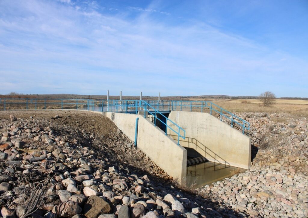
Currently, the gates of the Morecambe structure open in April during flood years to help move the excess water from spring flooding off the landscape before June. During natural flooding, the gates will open prior to the peak of the event to make room for the extra water and then close to prevent worsening the situation.
The Morecambe structure was installed with the intention of reducing flooding in the riparian area of Two Hills Country and alleviating the burden of flooding on the residents of the surrounding area. While the success of this endeavor varies from year to year and the area is susceptible to flooding due to the flat topography, the fact remains that there is no clear-cut solution. Challenges associated to coexisting with the floodplain and associated riparian area will inevitably fluctuate as the natural environment does and looking forward, climate change trends indicate that severe natural flooding and drought events will occur more frequently. With this in mind, is there a need to study the effectiveness of the Morecambe structure in relation to the impact of climate change on the local hydrologic regime?
While this structure has been controversial for some time, it has helped to reduce flood peaks and durations during smaller flooding events but ultimately, it has limited effectiveness during larger flooding events. Is it time to explore other options? Take a moment to consider ways to balance the needs of people and the ecological integrity of the floodplain in the Two Hills County riparian area and join the conversation about creating a better future.

Cassidy Odgers has a keen interest in water and soil management, striving to protect our natural resources for future generations. She feels it is important to preserve the integrity of the natural environment and the ecosystem services that all people rely on.
Ellie Hantke MacDonald is eager to integrate historical and current anthropogenic development into land-use planning. They aim to promote a balance between the conservation of our planet and the perpetual development of our society.
Sophie Tomsha is passionate about wildlife conservation and protecting habitats critical to sustain healthy populations. She is a strong advocate for natural systems and the importance of robust ecological interactions.
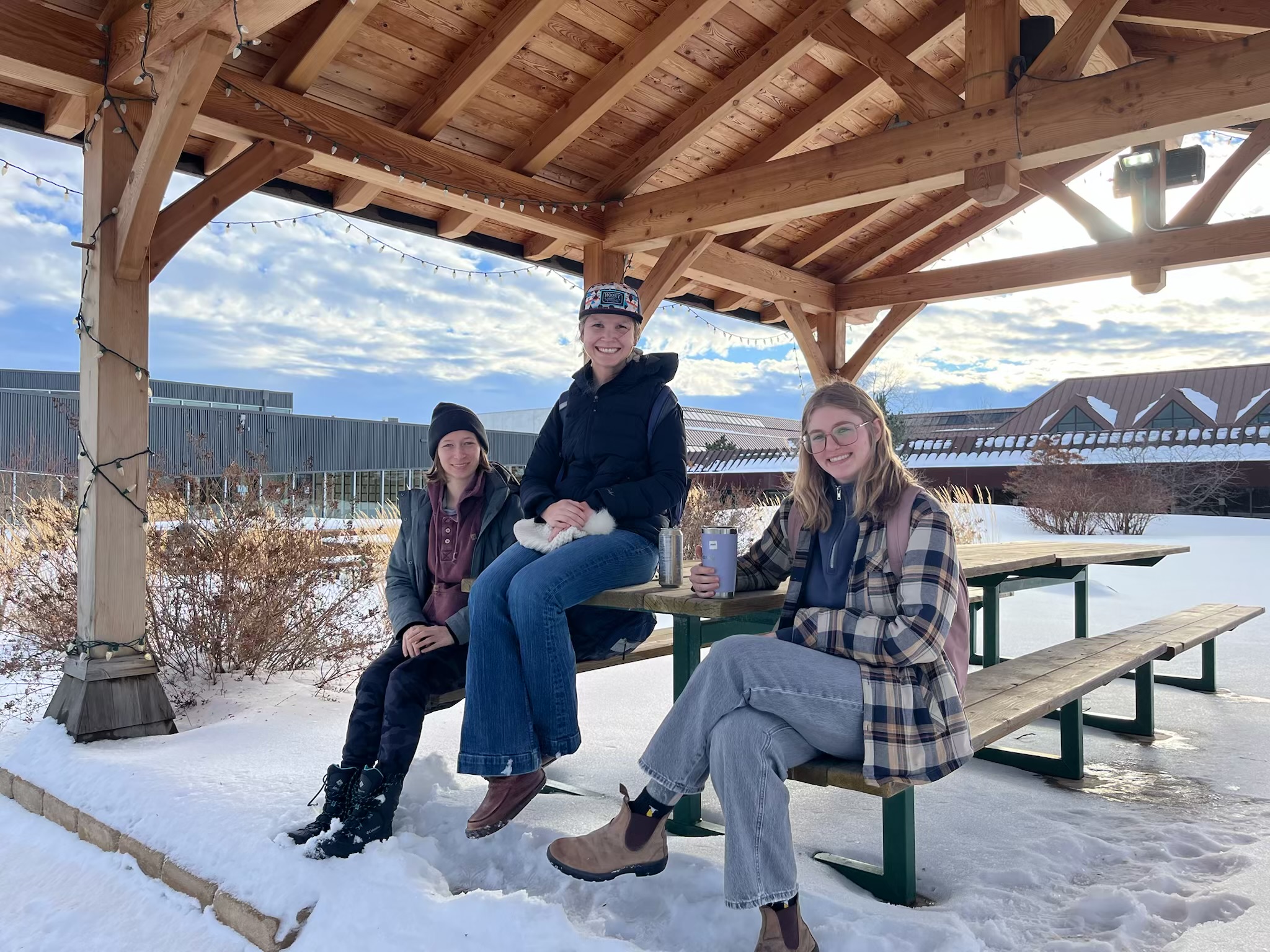
Cassidy, Ellie, and Sophie are students in the Bachelor of Applied Science in Environmental Management program at Lakeland College. This blog was written as a part of their Aquatic Habitat Protection course and reflects the effort to understand the infrastructure currently affecting the Vermilion River Watershed.
We would like to thank our instructor, Nicole Nadorozny and Operations Infrastructure Manager, Carlin Soehn, for their support and assistance. Writing this blog was a great opportunity for us to explore different perspectives on the Morecambe Structure, including its history and ongoing significance. We hope that our readers enjoy learning about this topic as much as we did.